The certificate
The certificate is the artifact that goes in a project file: one page carrying the verdict with its reasons, closure and misclosure, the computed area beside the area the document stated in that document’s own unit, and the full call table with every course’s verbatim source text.
Unlike the DXF it works on documents that refuse to locate themselves, because a blanket easement or an exhibit-only area is a finding worth filing. Plats and as-builts certify their identification.
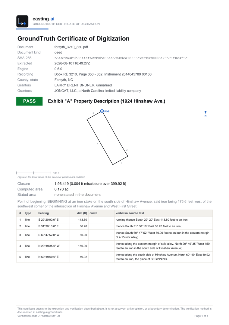
A real certificate for a 2014 Forsyth County deed: PASS at 1:96,419, the tract drawn to scale with its five courses numbered, the document’s SHA-256, and every course with the words it was read from. Open the full PDF.
Why the tract is drawn
Section titled “Why the tract is drawn”Closure and stated area can both be satisfied by a boundary that is mirrored or has a quadrant transposed, because those errors are symmetric and the arithmetic cannot see them. A reader can.
Each tract is drawn to scale and north up, with the point of beginning marked and every course numbered against its row in the table.
What it certifies, and what it does not
Section titled “What it certifies, and what it does not”The figure is in the traverse’s own plane and says so. It certifies the shape, never a position, because where a metes-and-bounds parcel sits on the earth is your click rather than something the service checked.
Every page carries a verification code, and the certificate states plainly that it attests to the extraction and the verification, not to a survey or a boundary opinion.
The signature
Section titled “The signature”The service signs each extraction when it returns it, and checks that signature before it renders anything. A response edited after the fact is refused rather than printed.
“The payload was modified after extraction” means certify the response as the API returned it. If you are building an integration, the usual cause is a JSON round-trip: see artifacts.
“Re-run the extraction” means the response predates signing.