Corrections
Extraction is not perfect, and the one thing you must never have to choose between is a correct number and a defensible document.
So the call table is editable. Double-click a bearing or a distance, type what the instrument says, and the service applies your reading, re-runs every check, and re-signs the result. The certificate still verifies afterwards, because the service made the change rather than you.
Nothing is overwritten. The extraction keeps what it read. Your correction rides beside it as a log carrying the old value, the new one, who changed it and why, and the certificate prints both readings side by side.
That is the opposite of a quiet edit, and it is the reason editing is safe here at all.
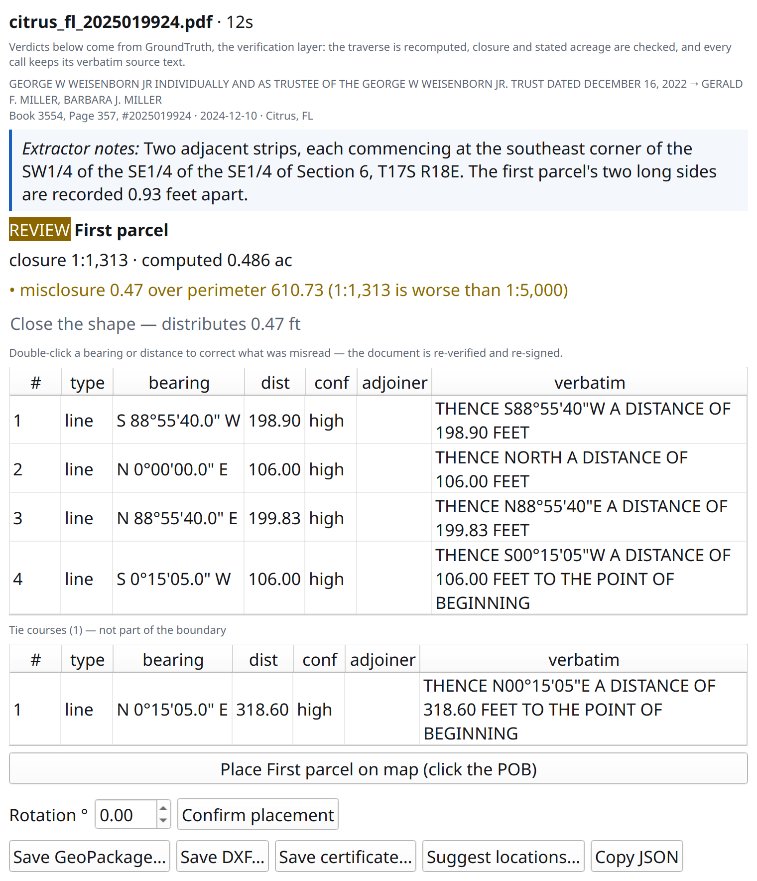
A Citrus County warranty deed. The strip’s two long sides are recorded 0.93 feet apart, so it miscloses at 1:1,313.
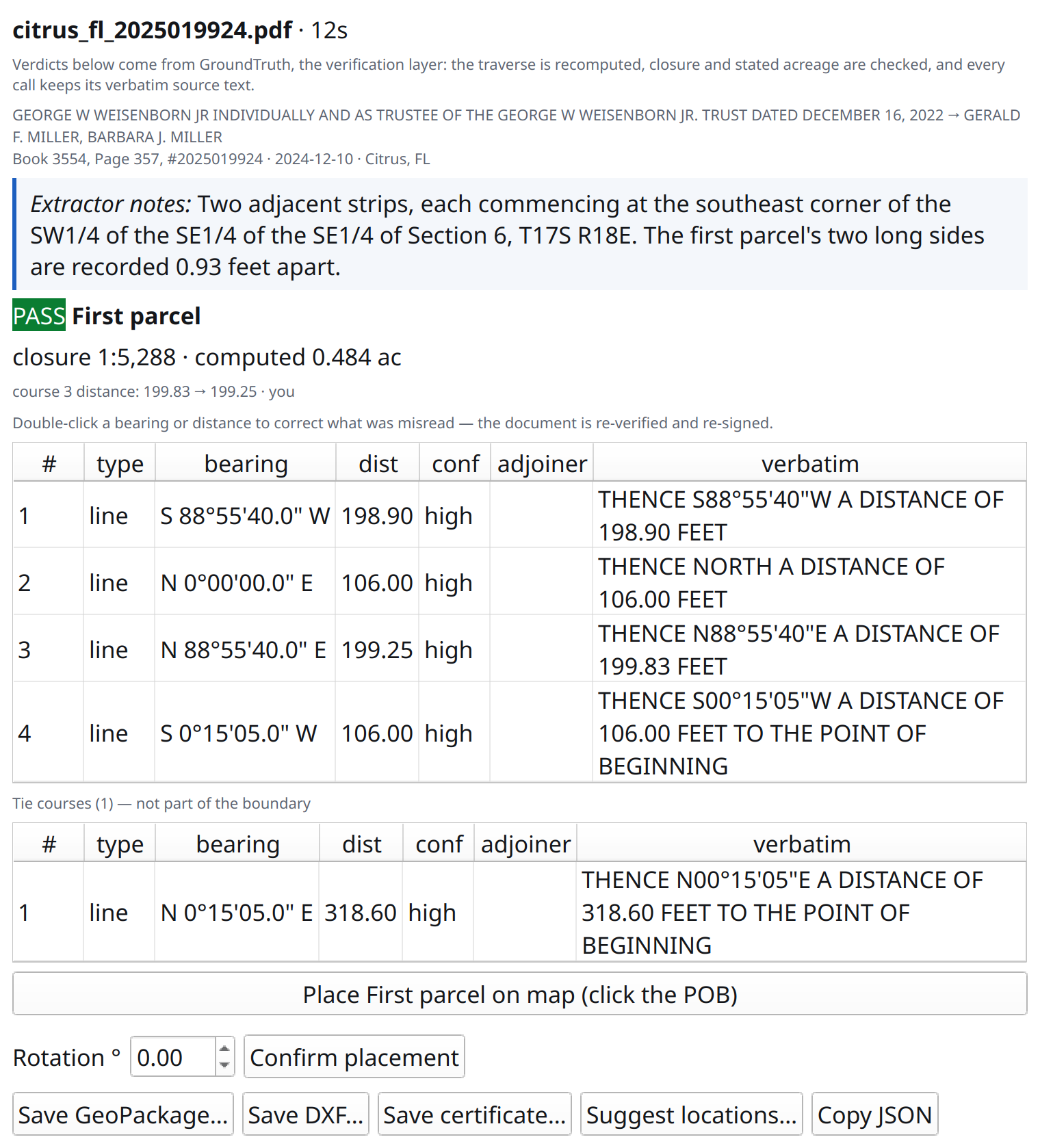
The same parcel after correcting course 3 to 199.25. The verdict was recomputed and earned a PASS at 1:5,288, the change is logged with who made it, and course 3 still quotes the sentence it was extracted from, 199.83 feet.
Verbatim source text is never editable. It is the document’s own words and the thing your correction is checked against, so a table that could rewrite it would make the diff meaningless.
Correcting is not adjusting
Section titled “Correcting is not adjusting”Two different things can be wrong with a description, and Easting keeps them apart on purpose.
A correction says the document reads something else and we misread it. A better reading of the same document, so the verdict is recomputed over your values and means exactly what a verdict always means. A corrected tract can move from REVIEW to PASS, and it earned it.
An adjustment says the recorded courses genuinely do not close and here is a best fit. The verdict does not move. The description still miscloses, the closure ratio still says so, and the fitted shape is a drafting and export aid rather than a finding.
Close the shape
Section titled “Close the shape”Runs the compass rule (Bowditch), distributing the misclosure across the courses in proportion to their length, which is what a surveyor has done by hand since 1807.
It is a button you press, never something that happens to you, and it tells you how much it will distribute before you press it. The certificate then prints the method, the misclosure it spread, and a line stating plainly that the recorded courses do not close and the verdict above judges the record.
That last part is the whole point. A tool that silently closes a failing traverse produces a drawing nobody downstream can question.
Where it works
Section titled “Where it works”Live in the browser, over the API, and in QGIS from plugin 0.8.0, which the plugin repository lists as of 2026-08-16. Update through Plugins → Manage and Install Plugins if yours is older.
Both surfaces send the same request and get back the same re-signed document, so the correction travels with the document rather than living in whichever client made it. Nothing is stored on our side.